
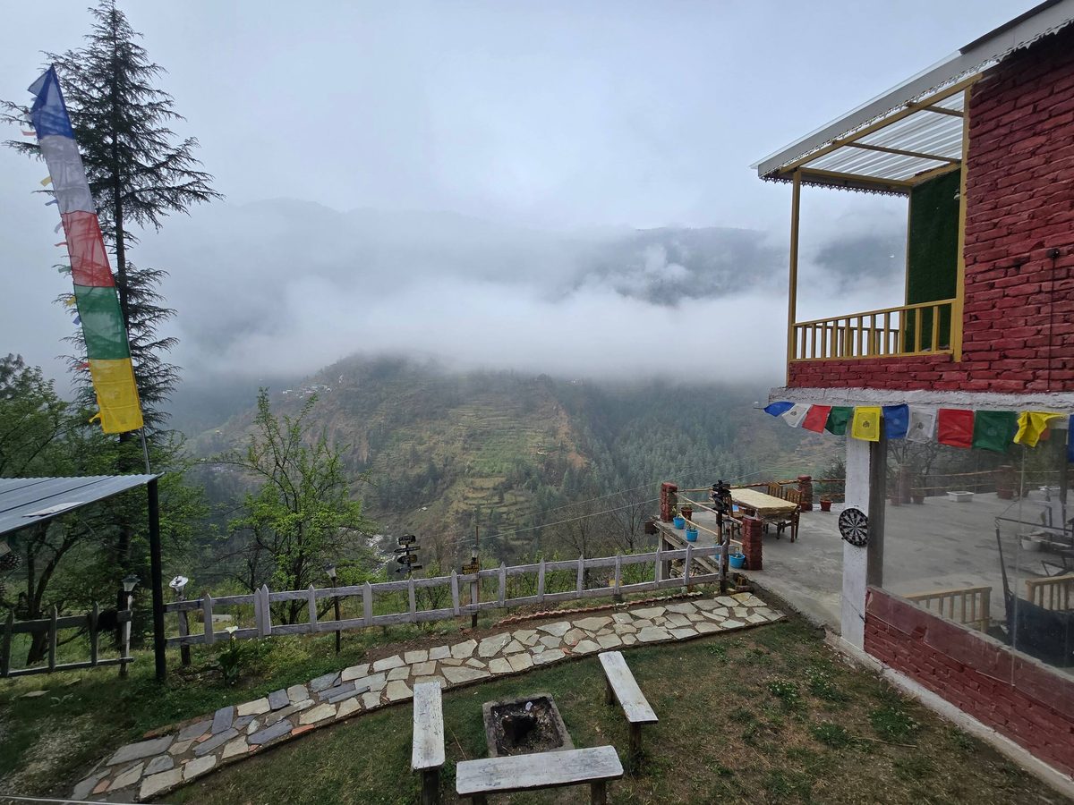
Things to do · Raghupur Fort
Raghupur Fort trek: the short, steep walk from Jalori Pass to a ruined fort
Where the fort is, how high it really is, the trail, the ruins, Serolsar or Raghupur, the weather by month and winter.
Short answer: Raghupur Fort (Raghupur Garh) is a ruined hill fort on an open ridge just west of Jalori Pass, listed as heritage by the Himachal Pradesh government. The trek is about 2.5 km each way from the pass: a kilometre of forest, then a steady climb of about 230 m to the ridge. Plan 2 to 3 hours there and back. The fort sits at about 3,300 m by elevation models (the national park's page says 3,540 m). Go from October to mid-November or May to June; in winter it depends on whether Jalori Pass road is open.
Planning the Raghupur Fort trek? We host guests in Chhet, a few minutes past Jibhi, and Raghupur is the shorter of the two walks that start at Jalori Pass. Here is where the fort is, how high it really is (the numbers online disagree), the trail from the pass, what is left of the fort, how it compares with Serolsar Lake, the weather by month, the winter question and camping.
Where is Raghupur Fort?
Raghupur Fort, also called Raghupur Garh, sits on an open grassy ridge just west of Jalori Pass, about 2 km from the pass in a straight line (OpenStreetMap). The Himachal Pradesh government lists it among the state's forts as archaeological heritage: "Raghupurgarh, Near Jalori Pass, Tehsil Ani" (HP Language, Art & Culture Department: list of archaeological heritage). So although you reach it from the Jibhi side, the fort itself is in Kullu district's Ani tehsil, on the Outer Seraj side of the pass.
From Jibhi, Jalori Pass is about 12–14 km up NH-305 via Shoja, roughly 45 minutes by car. The trek starts at the pass. Our Jalori Pass guide covers the drive and the road season.
| Raghupur Fort | At a glance |
|---|---|
| What it is | The ruins of an old hill fort on an open ridge above Jalori Pass |
| Listed as | Archaeological heritage by the Himachal Pradesh government: "Raghupurgarh, Near Jalori Pass, Tehsil Ani" |
| District | Kullu, on the Ani (Outer Seraj) side of Jalori Pass |
| Height | About 3,300 m by elevation models; the national park's page says about 3,540 m |
| Trek | About 2.5 km each way from Jalori Pass on the mapped path |
| Time | 2 to 3 hours from the pass and back, including time at the top |
| From Jibhi | Jalori Pass is about 12–14 km up NH-305, roughly 45 minutes by car |
| Best months | October to mid-November, and May to June |
How high is Raghupur Fort?
You will see two very different heights. The Great Himalayan National Park's Banjaar valley page puts the fort at "approximately 3540 mts" (GHNP: Banjaar Valley). Global elevation models put the fort site lower: about 3,290 m in Copernicus GLO-90 and about 3,300 m in SRTM, roughly 150–200 m above Jalori Pass (about 3,120 m). In feet, that is about 10,800 ft by the models, or about 11,600 ft by the park's figure.
We go with "about 3,300 m" for planning, because both models agree and they match the short climb from the pass. Either way, you are walking above 3,000 m: go slowly, drink water, and turn back if anyone gets a headache that will not go away or feels dizzy.
The trek from Jalori Pass
- Start: Jalori Pass, where the road tops out. The path heads west from the pass.
- Distance: about 2.5 km each way on the mapped path (OpenStreetMap measures 2.3 km from the pass to the fort). Travel blogs often say 3 km; it depends on where you start and which line you take.
- The shape of the walk: for roughly the first kilometre the path runs through forest, level to gently downhill. After that it climbs steadily, about 230 m, up open slopes to the ridge and the ruins. That means the way back starts downhill and ends with a short climb back up to the pass.
- Time: plan 2 to 3 hours from the pass and back, including time at the top, and about 4 to 5 hours door to door from Jibhi.
- Difficulty: short but steeper than Serolsar. Comfortable for an active family; take it slowly with children and older parents, and skip the last climb if anyone is struggling with the height.
- Water and food: carry your own water and snacks. There are tea stalls at the pass, but we would not count on anything on the trail.
- Shoes: trainers with a good grip are fine on a dry day; wet grass and loose stone near the top are slippery.
OpenStreetMap also marks a small temple beside the path on the way up (OpenStreetMap). As at any temple here, take your shoes off before you step inside.
What is left of the fort
Do not expect a palace. The national park describes Raghupur as "the location of an old fort built by the king of Kullu", adding that "the fort is surrounded by wide trenches and there is a small pond inside" and that its walls are marked by bullet holes from sieges (GHNP: Banjaar Valley). What you see today is long lines of dry-stone walls, rubble and grassy hollows on the ridge, a small stone shrine, and the view: the same page speaks of "fantastic views of the Outer Seraj valley" and snow-capped peaks in winter.


You will read many other stories online about who built the fort and when, and local tellings vary. We only repeat what the official sources say. It is listed heritage, so please do not climb on the walls, move stones or leave anything behind.
Raghupur Fort or Serolsar Lake?
Both walks start at Jalori Pass and go in opposite directions: Raghupur to the west, Serolsar to the east. They feel very different:
| Raghupur Fort | Serolsar Lake | |
|---|---|---|
| Distance from Jalori Pass | About 2.5 km each way | About 5 km each way |
| The walk | Forest first, then a steady climb up open slopes | Mostly gentle forest, rolling up and down |
| Height | Ends about 150–200 m above the pass | Lake at about 3,050–3,100 m, close to the pass |
| Time | 2–3 hours there and back | 1.5–2.5 hours each way |
| What you get | Wide ridge views and the fort ruins | A small sacred lake and the Budhi Nagin temple |
| Pick it if | You want big views in a short, steeper walk | You want a longer, easier forest walk |
Doing both in one day makes for a long day at altitude. If you only have one day, choose by what you want: views (Raghupur) or the forest and the lake (Serolsar). If you are staying a few nights, do one each day. The full lake guide is Serolsar Lake trek.
Best time and Raghupur Fort weather
Raghupur is about 1,500 m higher than Jibhi, so it is far colder than the village on the same day. Approximate averages at the fort's height, worked out from 2016–2025 reanalysis data and rounded:
| Month | Avg high / low at the fort | What it is like |
|---|---|---|
| Jan | 1°C / -9°C | Deep winter; Jalori road often shut after snow |
| Feb | 2°C / -9°C | Deep winter; snow likely on the ridge |
| Mar | 5°C / -5°C | Snow lingers; road may still be shut |
| Apr | 10°C / -2°C | Thawing; frosty nights, patchy snow |
| May | 13°C / 2°C | Good: green slopes, cool days |
| Jun | 15°C / 5°C | Good: mildest days before the rain |
| Jul | 16°C / 9°C | Monsoon: heavy rain, cloud, slippery trail |
| Aug | 16°C / 9°C | Monsoon: wettest with July |
| Sep | 14°C / 6°C | Rain easing late in the month |
| Oct | 11°C / 0°C | Best: dry and clear, freezing nights |
| Nov | 7°C / -4°C | Clear early on; first snow can close the road |
| Dec | 4°C / -7°C | Cold; snow can close the road |
How we worked these out: daily ERA5 reanalysis data from Open-Meteo historical weather (ERA5) for 2016–2025 at about 3,290 m. This is a model of a wide area, not a measurement on the ridge, and wind on the open top makes it feel colder. For a trip this week, check a live forecast.
- October to mid-November is the best window: dry, clear and good for views. Nights are cold; in the data, close to half of October nights and most November nights go below freezing at the fort.
- May and June are the other good months: green slopes and cool days.
- July and August bring heavy rain and cloud; the views often disappear and the grass and stone get slippery.
- December to March is snow season up here. Jalori Pass road often closes after the first heavy snow, usually from mid to late November, and can stay shut for weeks.
Raghupur Fort in winter and snow
"Is the Raghupur Fort trek open now?" really means "is Jalori Pass road open?". When the road is open after a dry early winter, the walk is possible with proper shoes, warm layers and local advice. When there is fresh snow, the road may not be open at all, and the ridge is no place to get caught. In January 2026, about five tourists camping in tents at Raghupur Garh were stranded overnight by heavy snow and strong winds and had to be brought down by a local rescue team (news report: NDTV India, 23 Jan 2026).


- Check the road and the forecast the evening before (see is Jalori Pass open?).
- Start early and be back at the car by early afternoon in winter; it gets dark early from November to January (sunrise and sunset times by month).
- If cloud or snow rolls in, turn back. Frost and black ice are common on shaded bends of the Jalori road after sunset.
- Snow is never certain on a given date. For what a winter trip is like lower down, read Jibhi snowfall.
Can you camp at Raghupur Fort?
The park's page says there is "good camping" at Raghupur (GHNP: Banjaar Valley), but the rules on the ground have changed. In May 2025 the Forest Department removed tents in the Raghupurgarh area, and the local Divisional Forest Officer said tourism there would be organised "on the lines of Saryolsar" (The Tribune, 18 May 2025). In August 2025, after local protests, Raghupur Garh was taken out of the state's eco-tourism site tender process (news report: Amar Ujala, 6 Aug 2025). Ask the forest staff or locally before you plan a night up there, never light fires on the ridge, and carry all your rubbish down. Our camping in Jibhi guide has the wider rules.
For the night sky without a cold night on the ridge, see stargazing in Jibhi.
A Raghupur day from Jibhi
- Morning: breakfast, then drive up to Jalori Pass; the hairpins above Shoja are easier with the morning light.
- Late morning: walk to the fort, sit on the ridge for a while, and walk back.
- Lunch: at the pass, or back down in Jibhi.
- Afternoon: drive down well before dark; from November to January, aim to be back by about 5 PM.
- Pack: water, snacks, a windproof layer, a cap or beanie, sunscreen and a small bag for rubbish. With a dog, keep it on a lead near grazing animals and the temple.
- For more day plans, see places near Jibhi within 50 km and things to do and treks near Jibhi.
Come back down to a warm cottage after the ridge
For a couple, the glass house in Jibhi is for up to 2 guests: the bed sits right beside the glass and the cottage has a glass roof, and it has its own private hot tub facing the mountains, a good place to warm up after a cold ridge. Room decoration, a cake and a candlelight dinner are available on request with 1 day's advance notice.
For a family, the mud house cottages in Chhet take up to 3 guests each or 6 with both, side by side with a shared patio and garden, a fire pit and a loft in each. You can drive right up to the door, which helps with parents and small children after a long day out, and our local chefs cook home-style meals from a menu. For a bigger group, the whole property sleeps 10 comfortably, and when you book all three cottages there are no other guests on site.
All three have a room heater, hot water runs 24x7 and there is power backup. A bonfire can be arranged on request at an extra charge, pets are welcome, and we can help arrange a taxi for your Jalori day (fares vary). Send your dates on WhatsApp and we will tell you what is free.
Sources: HP Language, Art & Culture Department: list of archaeological heritage; GHNP: Banjaar Valley; trail and fort location from OpenStreetMap (path length measured on the map, rounded); heights from Copernicus GLO-90 and SRTM elevation data; weather from Open-Meteo historical weather (ERA5); news: The Tribune, 18 May 2025, Amar Ujala, 6 Aug 2025, NDTV India, 23 Jan 2026. Trail, road and camping rules change, so follow forest staff, local signs and advice on the day.
Where to stay in Chhet, near Jibhi
Walking up to Raghupur Fort from Jalori? Peaks N Valley Stays is in Chhet (PIN 175123), a few minutes past Jibhi. Every cottage has a room heater, hot water runs 24x7 and there is power backup if the valley supply drops. You can drive right up to the door and park free, our local chefs cook home-style meals, and pets are welcome.
Couples usually pick the glass house in Jibhi: the bed sits right beside the glass and the cottage has a glass roof, with a private hot tub and the valley beside you, for up to 2 guests. Families and friends take the mud house cottages in Chhet, up to 3 guests each or 6 with both, side by side with a shared patio. Room decoration, a cake and a candlelight dinner are available on request with 1 day's advance notice. A bonfire can be arranged on request at an extra charge.
How long is the Raghupur Fort trek?
About 2.5 km each way from Jalori Pass on the mapped path: roughly a kilometre through forest, then a steady climb of about 230 m to the ridge. Plan 2 to 3 hours from the pass and back, including time at the top, and about 4 to 5 hours door to door from Jibhi.
What is the height of Raghupur Fort?
Elevation models (Copernicus GLO-90 and SRTM) put the fort at about 3,300 m, roughly 150 to 200 m above Jalori Pass, or about 10,800 ft. The Great Himalayan National Park's Banjaar valley page gives a higher figure, about 3,540 m.
Who built Raghupur Fort?
The Great Himalayan National Park describes it as an old fort built by the king of Kullu, with wide trenches, a small pond inside and walls marked by bullet holes from sieges. The Himachal Pradesh government lists it as archaeological heritage: Raghupurgarh, near Jalori Pass, Tehsil Ani. Only ruined walls remain.
Is the Raghupur Fort trek open in winter?
Only when Jalori Pass road is open. The road often closes after the first heavy snow, usually from mid to late November, and can stay shut for weeks. After a dry early winter the walk is possible with proper shoes and local advice; in fresh snow, do not go up, and do not camp on the ridge.
Raghupur Fort or Serolsar Lake: which is better?
Both start at Jalori Pass. Raghupur is shorter (about 2.5 km each way) but steeper, with wide ridge views and fort ruins. Serolsar is longer (about 5 km each way) but gentler, through forest to a small sacred lake. Doing both in one day makes for a long day at altitude.
Keep exploring
Related pages
Shoja village guide: altitude, weather and places to visit → Glass house in Jibhi → Mud house cottages in Chhet → Whole property for groups (sleeps 10) → Serolsar Lake trek → Jalori Pass and Serolsar Lake → Camping in Jibhi → Places near Jibhi within 50 km → Things to do and treks near Jibhi → Book and contact →Where to stay
Stay with us in Chhet, near Jibhi
- Glass House in Jibhi with a private hot tub, for couples
- Mud house cottages in Chhet, Tirthan Valley, for families and friends
- Pet friendly stay in Jibhi: every cottage welcomes dogs
- Book a cottage in Jibhi direct on WhatsApp